King of the Hammers Lowrance Map
Item #: 3023
$ 99.99
$ 99.99
Retail Price:
Retail Price:
Shipping calculated at checkout.
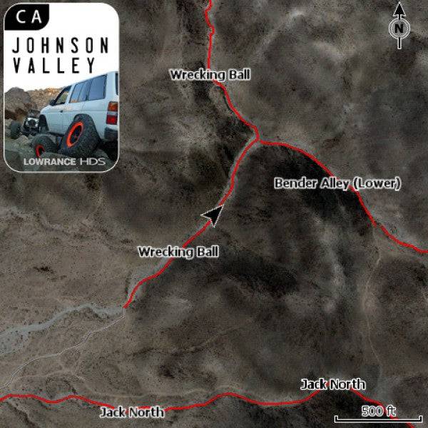
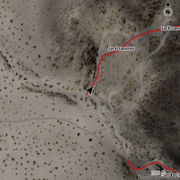
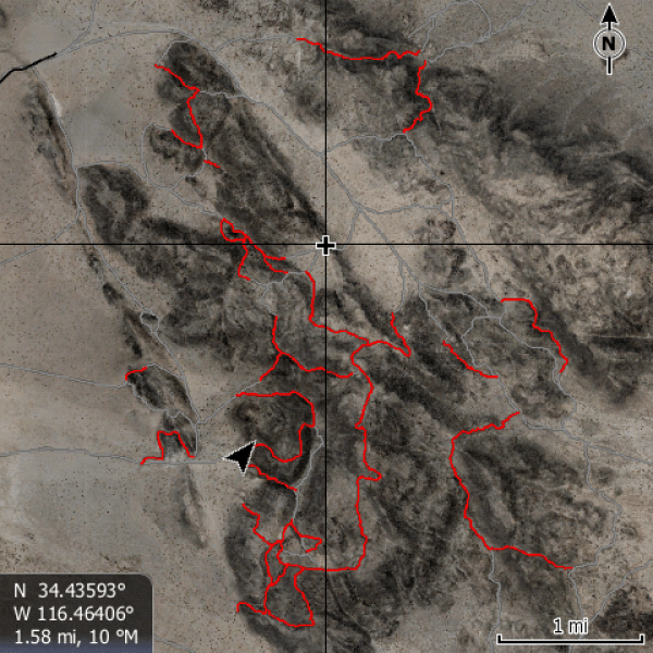
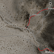
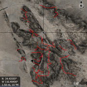
Add Satellite imagery (1m/px), Points of interest, over 35 trails, local roads & highways to your Lowrance HDS or Elite for the Johnson Valley, California area.
- 4GB Micro SD Card with SD adapter
- Files are encrypted and cannot be copied, one map card per GPS
Trails on the card:
- Aftershock
- Backdoor
- Bender Alley (Lower)
- Bender Alley (Upper)
- Big Johnson (Lower)
- Big Johnson (Upper)
- Bloody Mary
- Boulderdash
- Chocolate Thunder
- Clawhammer
- Elvis
- Fissure Mountain
- Full of Hate
- Full of Love
- Gatekeeper (Project)
- Highway 19
- Highway 20
- Jack North
- Jackhammer
- Misery Mile
- Moonshine
- Nightmare
- Outer Limits
- Resolution
- Scooby Snack
- Short Bus
- Sledgehammer
- Sledgehammer (Upper)
- Sledgehammer Exit
- Sledhammer (Upper)
- Spooners
- Stickies on Sixties
- Sunbonnet Pass
- Tack Hammer
- Turkey Claw
- Wrecking Ball
Instructions
- Insert the card and if asked "Do you wish to change chart data selection to view inserted charts" Select yes.
- To change your GPS settings to show the satellite imagery on the HDS Live, Press Menu, Select More Options, Select Chart Options, Select Chart Detail, select Full. Select Photo Overlay and Select Full.
- When you change the map to be the satellite imagery - it is only reading that map. Your normal background mapping is not visible, only the area with the satellite imagery. To switch in between the two on the HDS Live, Press Menu, Select More Options, Select Chart Source. "C-MAP US..." is the factory map, "Lowrance" is usually the satellite imagery map.
Click here for downloadable instructions
{"id":144931815433,"title":"King of the Hammers Lowrance Map","handle":"king-of-the-hammers-topo-software-v3","description":"\u003cp\u003eAdd Satellite imagery (1m\/px), Points of interest, over 35 trails, local roads \u0026amp; highways to your Lowrance HDS or Elite for the Johnson Valley, California area.\u003cbr\u003e\u003c\/p\u003e\n\u003cul\u003e\n\u003cli\u003e\u003cspan\u003e4GB Micro SD Card with SD adapter\u003c\/span\u003e\u003c\/li\u003e\n\u003cli\u003eFiles are encrypted and cannot be copied, one map card per GPS\u003c\/li\u003e\n\u003c\/ul\u003e\n\u003cp\u003e\u003cbr\u003e\u003cspan\u003eTrails on the card: \u003c\/span\u003e\u003c\/p\u003e\n\u003cul\u003e\n\u003cli\u003e\u003cspan\u003eAftershock\u003c\/span\u003e\u003c\/li\u003e\n\u003cli\u003e\u003cspan\u003eBackdoor\u003c\/span\u003e\u003c\/li\u003e\n\u003cli\u003e\u003cspan\u003eBender Alley (Lower)\u003c\/span\u003e\u003c\/li\u003e\n\u003cli\u003e\u003cspan\u003eBender Alley (Upper)\u003c\/span\u003e\u003c\/li\u003e\n\u003cli\u003e\u003cspan\u003eBig Johnson (Lower)\u003c\/span\u003e\u003c\/li\u003e\n\u003cli\u003e\u003cspan\u003eBig Johnson (Upper)\u003c\/span\u003e\u003c\/li\u003e\n\u003cli\u003e\u003cspan\u003eBloody Mary\u003c\/span\u003e\u003c\/li\u003e\n\u003cli\u003e\u003cspan\u003eBoulderdash\u003c\/span\u003e\u003c\/li\u003e\n\u003cli\u003e\u003cspan\u003eChocolate Thunder\u003c\/span\u003e\u003c\/li\u003e\n\u003cli\u003e\u003cspan\u003eClawhammer\u003c\/span\u003e\u003c\/li\u003e\n\u003cli\u003e\u003cspan\u003eElvis\u003c\/span\u003e\u003c\/li\u003e\n\u003cli\u003e\u003cspan\u003eFissure Mountain\u003c\/span\u003e\u003c\/li\u003e\n\u003cli\u003e\u003cspan\u003eFull of Hate\u003c\/span\u003e\u003c\/li\u003e\n\u003cli\u003e\u003cspan\u003eFull of Love\u003c\/span\u003e\u003c\/li\u003e\n\u003cli\u003e\u003cspan\u003eGatekeeper (Project)\u003c\/span\u003e\u003c\/li\u003e\n\u003cli\u003e\u003cspan\u003eHighway 19\u003c\/span\u003e\u003c\/li\u003e\n\u003cli\u003e\u003cspan\u003eHighway 20\u003c\/span\u003e\u003c\/li\u003e\n\u003cli\u003e\u003cspan\u003eJack North\u003c\/span\u003e\u003c\/li\u003e\n\u003cli\u003e\u003cspan\u003eJackhammer\u003c\/span\u003e\u003c\/li\u003e\n\u003cli\u003e\u003cspan\u003eMisery Mile\u003c\/span\u003e\u003c\/li\u003e\n\u003cli\u003e\u003cspan\u003eMoonshine\u003c\/span\u003e\u003c\/li\u003e\n\u003cli\u003e\u003cspan\u003eNightmare\u003c\/span\u003e\u003c\/li\u003e\n\u003cli\u003eOuter Limits\u003c\/li\u003e\n\u003cli\u003eResolution\u003c\/li\u003e\n\u003cli\u003eScooby Snack\u003c\/li\u003e\n\u003cli\u003eShort Bus\u003c\/li\u003e\n\u003cli\u003eSledgehammer\u003c\/li\u003e\n\u003cli\u003eSledgehammer (Upper)\u003c\/li\u003e\n\u003cli\u003eSledgehammer Exit\u003c\/li\u003e\n\u003cli\u003eSledhammer (Upper)\u003c\/li\u003e\n\u003cli\u003eSpooners\u003c\/li\u003e\n\u003cli\u003eStickies on Sixties\u003c\/li\u003e\n\u003cli\u003eSunbonnet Pass\u003c\/li\u003e\n\u003cli\u003eTack Hammer\u003c\/li\u003e\n\u003cli\u003eTurkey Claw\u003c\/li\u003e\n\u003cli\u003eWrecking Ball\u003c\/li\u003e\n\u003c\/ul\u003e\n\u003cp\u003e \u003c\/p\u003e\n\u003ch5\u003eInstructions \u003c\/h5\u003e\n\u003cul\u003e\n\u003cli\u003eInsert the card and if asked \"Do you wish to change chart data selection to view inserted charts\" Select yes.\u003c\/li\u003e\n\u003cli\u003eTo change your GPS settings to show the satellite imagery on the HDS Live, Press Menu, Select More Options, Select Chart Options, Select Chart Detail, select Full. Select Photo Overlay and Select Full.\u003c\/li\u003e\n\u003cli\u003eWhen you change the map to be the satellite imagery - it is only reading that map. Your normal background mapping is not visible, only the area with the satellite imagery. To switch in between the two on the HDS Live, Press Menu, Select More Options, Select Chart Source. \"C-MAP US...\" is the factory map, \"Lowrance\" is usually the satellite imagery map. \u003c\/li\u003e\n\u003c\/ul\u003e\n\u003cp\u003e\u003ca href=\"https:\/\/cdn.shopify.com\/s\/files\/1\/0769\/1859\/files\/PCI_Rugged_Routes_Sat_Imagery_GPS_Instructions_b01a5fc3-71b8-43a0-b118-7234f940d02b.pdf?v=1646167340\" target=\"_blank\" data-mce-href=\"https:\/\/cdn.shopify.com\/s\/files\/1\/0769\/1859\/files\/PCI_Rugged_Routes_Sat_Imagery_GPS_Instructions_b01a5fc3-71b8-43a0-b118-7234f940d02b.pdf?v=1646167340\"\u003eClick here for downloadable instructions\u003c\/a\u003e\u003c\/p\u003e\n\u003cul\u003e\u003c\/ul\u003e\n\u003cstyle\u003e\u003c\/style\u003e\n\u003cstyle\u003e\u003c\/style\u003e","published_at":"2018-01-08T21:33:43-08:00","created_at":"2018-01-08T21:38:02-08:00","vendor":"PCI Race Radios","type":"","tags":[],"price":9999,"price_min":9999,"price_max":9999,"available":true,"price_varies":false,"compare_at_price":null,"compare_at_price_min":0,"compare_at_price_max":0,"compare_at_price_varies":false,"variants":[{"id":1708383109129,"title":"Default Title","option1":"Default Title","option2":null,"option3":null,"sku":"3023","requires_shipping":true,"taxable":true,"featured_image":null,"available":true,"name":"King of the Hammers Lowrance Map","public_title":null,"options":["Default Title"],"price":9999,"weight":454,"compare_at_price":null,"inventory_quantity":0,"inventory_management":null,"inventory_policy":"deny","barcode":"003023","requires_selling_plan":false,"selling_plan_allocations":[],"quantity_rule":{"min":1,"max":null,"increment":1}}],"images":["\/\/www.pciraceradios.com\/cdn\/shop\/files\/pci-race-radios-default-title-king-of-the-hammers-lowrance-map-798305943561.jpg?v=1736203861","\/\/www.pciraceradios.com\/cdn\/shop\/files\/pci-race-radios-default-title-king-of-the-hammers-lowrance-map-798305779721.png?v=1736203866","\/\/www.pciraceradios.com\/cdn\/shop\/files\/pci-race-radios-default-title-king-of-the-hammers-lowrance-map-798305878025.png?v=1736203863"],"featured_image":"\/\/www.pciraceradios.com\/cdn\/shop\/files\/pci-race-radios-default-title-king-of-the-hammers-lowrance-map-798305943561.jpg?v=1736203861","options":["Title"],"media":[{"alt":"King of the Hammers Lowrance Map - PCI Race Radios","id":35163735261425,"position":1,"preview_image":{"aspect_ratio":1.0,"height":600,"width":600,"src":"\/\/www.pciraceradios.com\/cdn\/shop\/files\/pci-race-radios-default-title-king-of-the-hammers-lowrance-map-798305943561.jpg?v=1736203861"},"aspect_ratio":1.0,"height":600,"media_type":"image","src":"\/\/www.pciraceradios.com\/cdn\/shop\/files\/pci-race-radios-default-title-king-of-the-hammers-lowrance-map-798305943561.jpg?v=1736203861","width":600},{"alt":"King of the Hammers Lowrance Map - PCI Race Radios","id":35163735720177,"position":2,"preview_image":{"aspect_ratio":1.0,"height":600,"width":600,"src":"\/\/www.pciraceradios.com\/cdn\/shop\/files\/pci-race-radios-default-title-king-of-the-hammers-lowrance-map-798305779721.png?v=1736203866"},"aspect_ratio":1.0,"height":600,"media_type":"image","src":"\/\/www.pciraceradios.com\/cdn\/shop\/files\/pci-race-radios-default-title-king-of-the-hammers-lowrance-map-798305779721.png?v=1736203866","width":600},{"alt":"King of the Hammers Lowrance Map - PCI Race Radios","id":35163735458033,"position":3,"preview_image":{"aspect_ratio":1.0,"height":600,"width":600,"src":"\/\/www.pciraceradios.com\/cdn\/shop\/files\/pci-race-radios-default-title-king-of-the-hammers-lowrance-map-798305878025.png?v=1736203863"},"aspect_ratio":1.0,"height":600,"media_type":"image","src":"\/\/www.pciraceradios.com\/cdn\/shop\/files\/pci-race-radios-default-title-king-of-the-hammers-lowrance-map-798305878025.png?v=1736203863","width":600}],"requires_selling_plan":false,"selling_plan_groups":[],"content":"\u003cp\u003eAdd Satellite imagery (1m\/px), Points of interest, over 35 trails, local roads \u0026amp; highways to your Lowrance HDS or Elite for the Johnson Valley, California area.\u003cbr\u003e\u003c\/p\u003e\n\u003cul\u003e\n\u003cli\u003e\u003cspan\u003e4GB Micro SD Card with SD adapter\u003c\/span\u003e\u003c\/li\u003e\n\u003cli\u003eFiles are encrypted and cannot be copied, one map card per GPS\u003c\/li\u003e\n\u003c\/ul\u003e\n\u003cp\u003e\u003cbr\u003e\u003cspan\u003eTrails on the card: \u003c\/span\u003e\u003c\/p\u003e\n\u003cul\u003e\n\u003cli\u003e\u003cspan\u003eAftershock\u003c\/span\u003e\u003c\/li\u003e\n\u003cli\u003e\u003cspan\u003eBackdoor\u003c\/span\u003e\u003c\/li\u003e\n\u003cli\u003e\u003cspan\u003eBender Alley (Lower)\u003c\/span\u003e\u003c\/li\u003e\n\u003cli\u003e\u003cspan\u003eBender Alley (Upper)\u003c\/span\u003e\u003c\/li\u003e\n\u003cli\u003e\u003cspan\u003eBig Johnson (Lower)\u003c\/span\u003e\u003c\/li\u003e\n\u003cli\u003e\u003cspan\u003eBig Johnson (Upper)\u003c\/span\u003e\u003c\/li\u003e\n\u003cli\u003e\u003cspan\u003eBloody Mary\u003c\/span\u003e\u003c\/li\u003e\n\u003cli\u003e\u003cspan\u003eBoulderdash\u003c\/span\u003e\u003c\/li\u003e\n\u003cli\u003e\u003cspan\u003eChocolate Thunder\u003c\/span\u003e\u003c\/li\u003e\n\u003cli\u003e\u003cspan\u003eClawhammer\u003c\/span\u003e\u003c\/li\u003e\n\u003cli\u003e\u003cspan\u003eElvis\u003c\/span\u003e\u003c\/li\u003e\n\u003cli\u003e\u003cspan\u003eFissure Mountain\u003c\/span\u003e\u003c\/li\u003e\n\u003cli\u003e\u003cspan\u003eFull of Hate\u003c\/span\u003e\u003c\/li\u003e\n\u003cli\u003e\u003cspan\u003eFull of Love\u003c\/span\u003e\u003c\/li\u003e\n\u003cli\u003e\u003cspan\u003eGatekeeper (Project)\u003c\/span\u003e\u003c\/li\u003e\n\u003cli\u003e\u003cspan\u003eHighway 19\u003c\/span\u003e\u003c\/li\u003e\n\u003cli\u003e\u003cspan\u003eHighway 20\u003c\/span\u003e\u003c\/li\u003e\n\u003cli\u003e\u003cspan\u003eJack North\u003c\/span\u003e\u003c\/li\u003e\n\u003cli\u003e\u003cspan\u003eJackhammer\u003c\/span\u003e\u003c\/li\u003e\n\u003cli\u003e\u003cspan\u003eMisery Mile\u003c\/span\u003e\u003c\/li\u003e\n\u003cli\u003e\u003cspan\u003eMoonshine\u003c\/span\u003e\u003c\/li\u003e\n\u003cli\u003e\u003cspan\u003eNightmare\u003c\/span\u003e\u003c\/li\u003e\n\u003cli\u003eOuter Limits\u003c\/li\u003e\n\u003cli\u003eResolution\u003c\/li\u003e\n\u003cli\u003eScooby Snack\u003c\/li\u003e\n\u003cli\u003eShort Bus\u003c\/li\u003e\n\u003cli\u003eSledgehammer\u003c\/li\u003e\n\u003cli\u003eSledgehammer (Upper)\u003c\/li\u003e\n\u003cli\u003eSledgehammer Exit\u003c\/li\u003e\n\u003cli\u003eSledhammer (Upper)\u003c\/li\u003e\n\u003cli\u003eSpooners\u003c\/li\u003e\n\u003cli\u003eStickies on Sixties\u003c\/li\u003e\n\u003cli\u003eSunbonnet Pass\u003c\/li\u003e\n\u003cli\u003eTack Hammer\u003c\/li\u003e\n\u003cli\u003eTurkey Claw\u003c\/li\u003e\n\u003cli\u003eWrecking Ball\u003c\/li\u003e\n\u003c\/ul\u003e\n\u003cp\u003e \u003c\/p\u003e\n\u003ch5\u003eInstructions \u003c\/h5\u003e\n\u003cul\u003e\n\u003cli\u003eInsert the card and if asked \"Do you wish to change chart data selection to view inserted charts\" Select yes.\u003c\/li\u003e\n\u003cli\u003eTo change your GPS settings to show the satellite imagery on the HDS Live, Press Menu, Select More Options, Select Chart Options, Select Chart Detail, select Full. Select Photo Overlay and Select Full.\u003c\/li\u003e\n\u003cli\u003eWhen you change the map to be the satellite imagery - it is only reading that map. Your normal background mapping is not visible, only the area with the satellite imagery. To switch in between the two on the HDS Live, Press Menu, Select More Options, Select Chart Source. \"C-MAP US...\" is the factory map, \"Lowrance\" is usually the satellite imagery map. \u003c\/li\u003e\n\u003c\/ul\u003e\n\u003cp\u003e\u003ca href=\"https:\/\/cdn.shopify.com\/s\/files\/1\/0769\/1859\/files\/PCI_Rugged_Routes_Sat_Imagery_GPS_Instructions_b01a5fc3-71b8-43a0-b118-7234f940d02b.pdf?v=1646167340\" target=\"_blank\" data-mce-href=\"https:\/\/cdn.shopify.com\/s\/files\/1\/0769\/1859\/files\/PCI_Rugged_Routes_Sat_Imagery_GPS_Instructions_b01a5fc3-71b8-43a0-b118-7234f940d02b.pdf?v=1646167340\"\u003eClick here for downloadable instructions\u003c\/a\u003e\u003c\/p\u003e\n\u003cul\u003e\u003c\/ul\u003e\n\u003cstyle\u003e\u003c\/style\u003e\n\u003cstyle\u003e\u003c\/style\u003e"}


